Annex A - User Guide
Contributor IDs and how to find valuation information
The contributor_id is the property identifier provided by the jurisdiction that is searchable for land valuation and rates purposes.
An example of this can be seen for the Queensland property parcel (orange polygon) with contributor_id of ‘40056701’ (white text) located at 148.18481°, -25.51161° shown on the image below.
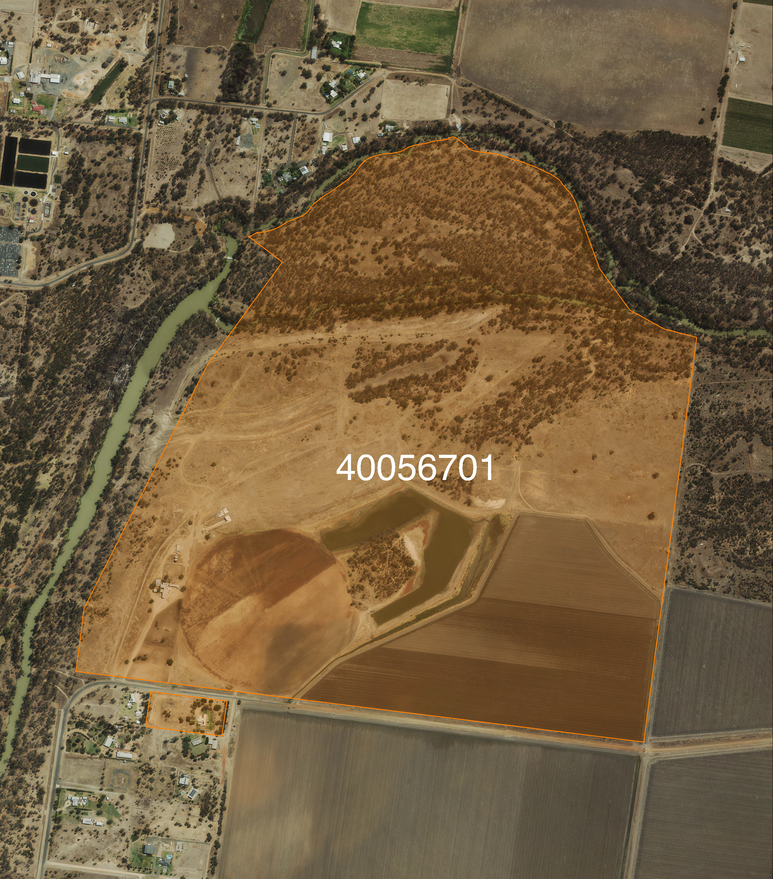
Queensland property parcel with © Aerometrex Ltd Aerial Imagery [Aerometrex, 2023].
Note
Properties with base_property = ‘Yes’ are the only searchable properties in Queensland.
The valuation for this parcel can be found through the Queensland land valuation website: https://www.resources.qld.gov.au/qld/environment/land/title/valuation/search.
To do this, input the contributor_id of the parcel (40056701) into the search bar as this is the National Property ID. The returned valuation information for this property is shown below.
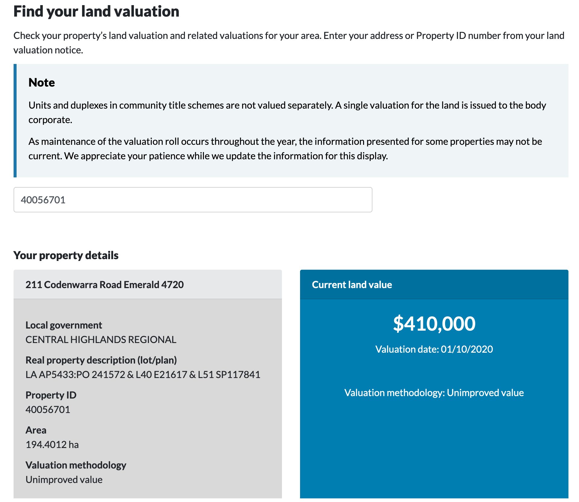
Screenshot taken from Queensland land valuation website [Queensland Government, 2024]. Available under CC BY 4.0 licence.
Base polygons and how they represent a non-overlapping property layer
Base property features are properties that have been flagged with the intention of providing a non-overlapping layer representation of properties. A user can simply identify these records by selecting where base_property = ‘Yes’.
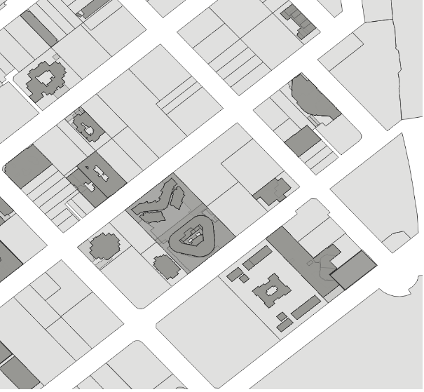
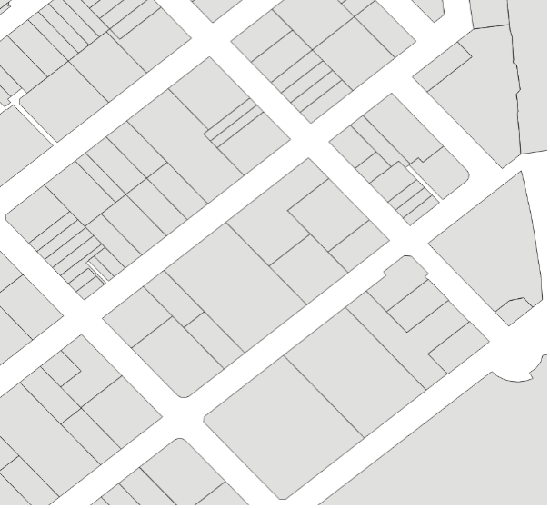
Below, the two images show the property layer with no filter applied (left), as well as only where base_property equals ‘Yes’ (right).
|
|
No Filter applied. |
Filtered on base_property = ‘Yes’. |
Below, the base property layer is shown for a site in Queensland (orange polygons) with the searchable contributor_ids labelled in white text.

Queensland base property example with ©Aerometrex Ltd Aerial Imagery [Aerometrex, 2023].
Linking National Cadastre and National Property
The property_cadastre table provides a linkage between National Property and National Cadastre through the property_pid and cadastre_pid.
National Property to National Cadastre
For example, at 130.84019138, -12.43302423 in the Northern Territory, there is a property polygon with a property_pid of ‘prpafc82e6b6d7e’ and contributor_id of ‘CUFT/778/934’. When this property_pid is searched in the property_cadastre table, the property_pid is shown to link to three cadastre_pids (shown below).
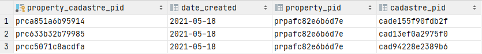
The three cadastre_pids relate to three cadastre records, with the related parcel_ids shown below.
National Cadastre to National Property
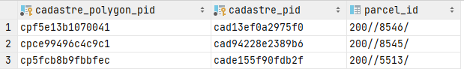
An example of the link in the other direction can be seen for the Victorian cadastre polygon at 144.962222249, -37.772255012 with cadastre_pid of ‘cad7de4f40ee0d9’ and parcel_id of ‘1TP619430’. This cadastre_pid links to 16 property_pids (shown below) in the property_cadastre table.
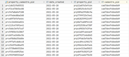
These 16 property_pids relate to 16 property records, with related contributor_ids shown below.
Linking CadLite to National Property
A linkage table has been included to facilitate the transition between the CadLite Property theme and the new National Property product. This table enables the link between the Property_Point and Property_Polygon features in CadLite to their corresponding National Property feature where possible. The link was created by matching the CadLite jurisdiction_id with the National Property contributor_id, supported by a spatial comparison where there was more than one match resulting from the join.
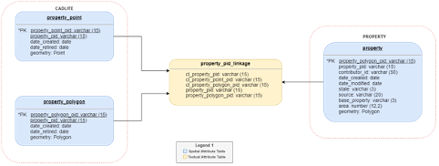
If a property does not have a record in the linkage table, a link between CadLite and National Property could not be created. This occurred where:
- There was no match between the CadLite jurisdiction_id and a National Property contributor_id. This may happen if:
– The feature is no longer represented in National Property, - The CadLite jurisdiction_id no longer exists, – The National Property contributor_id is new, or – The values could not confidently be joined during the linking process
- There were multiple matches between a CadLite jurisdiction_id and a National Property contributor_id and:
– The spatial check did not support the join, or – The spatial check could not identify a one-to-one link