Data Product Identification
Title
National Trees
Alternate Titles
Formerly known as ‘Geoscape Trees’.
Trees for Australia
Abstract
National Trees is a raster dataset representing tree coverage and heights across Australia, derived from remotely sensed data.
Description
The National Trees theme consists of a single trees layer. The trees layer consists of a digital pixel representation tree coverage and their associated heights derived through DEMs. The Theme is comprised of pre-defined urban areas at a two-metre resolution. The distribution corresponds to the tree type pixel in the National Surface Cover product.
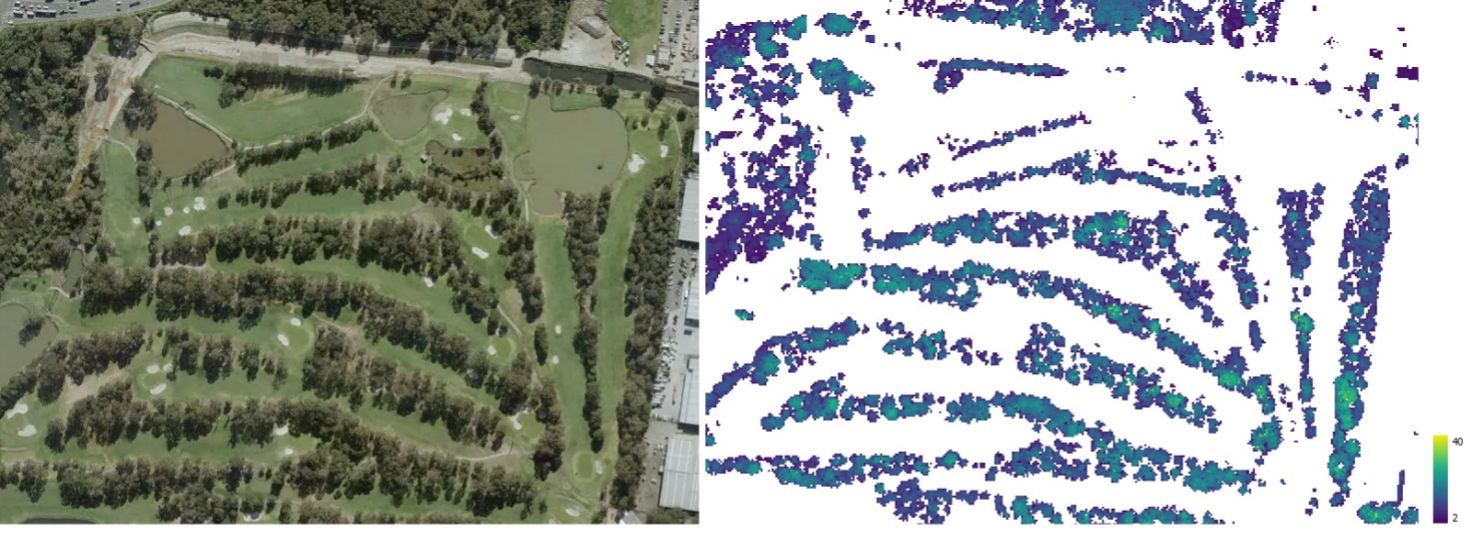
Geoscape National Trees product (right) alongside © Aerometrex Ltd Aerial Imagery [Aerometrex, 2023].
Data quality and potential capture timelines will vary across Australia based on three categories. Each category has been developed based on several factors defined by the population distribution (categorised based on population size), industrial/commercial activities, the probability of natural events (e.g. flooding) and the image source.
Urban (satellite source) - areas with a population greater than 200, or with significant industrial/commercial activity in a visual assessment, digitised from satellite imagery
Urban (aerial source) - areas with a population greater than 200, or with significant industrial/commercial activity in a visual assessment, digitised from aerial imagery
Rural - all other areas
Purpose
The purpose of National Trees is to spatially represent tree coverage and tree heights for use by industry and government in geographic information systems and/or other information systems.
Topic Category
Raster spatial data.
Geographic Description
The spatial coverage of National Trees includes Australia’s land mass. The Bounding Box for this data is as follows:
North bounding latitude: -9˚
South bounding latitude: -44˚
East bounding longitude: 160˚
West bounding longitude: 100˚
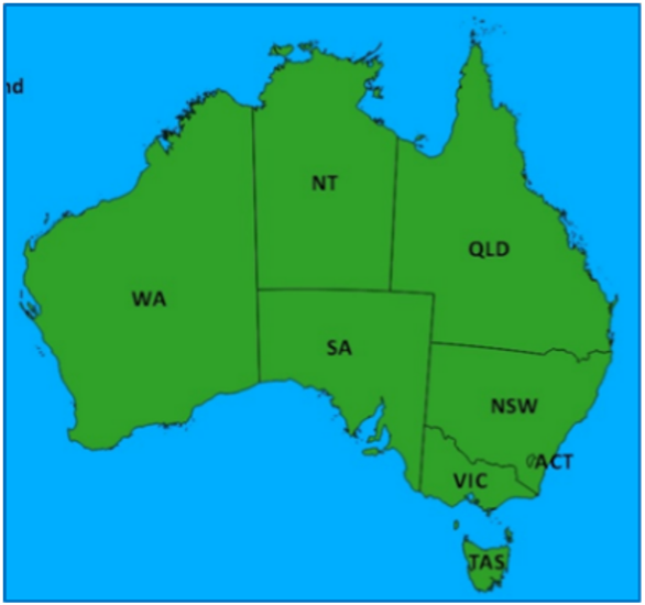
Geographic Extent Name
The States and Territories within Australia are represented by the following:
State or Territory Name |
Abbreviation |
|---|---|
New South Wales |
NSW |
Victoria |
VIC |
Queensland |
QLD |
South Australia |
SA |
Western Australia |
WA |
Tasmania |
TAS |
Northern Territory |
NT |
Australian Capital Territory |
ACT |
Note
Geoscape has adopted the Australian Bureau of Statistics (ABS) definition of ‘Other Territories’ (OT). It includes the Territory of Christmas Island, Territory of Cocos (Keeling) Islands, Jervis Bay Territory and Norfolk Island. OT does not include any other external Territory.